Volunteers
Meteorological indicators
| Fire Indicator |
| Fog Indicator |
News
Project presentation
FUNDING
Partners – Contact
The European Path E6
The European Path E6
The European path E6 begins from the Scandinavian peninsula, and crossing Europe from north to south reaches the port of Igoumenitsa. From there, it ends at mount Feggari in Samothraki. Its total length is some
The E paths have been made in 1990 by the Hellenic Federation of Mountaineering and Climbing, which also undertook the difficult task of placing signs with the assistance of local mountaineering clubs. In the process, poles, square signs on trees and paint on rocks were used. The colors of European paths are yellow and black. Many excursionists from Greece and the rest of Europe have crossed it either with 4x4 vehicles or with mountain bikes, as well as by air or mountaineering.
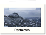
E6 traverses almost the entire crest of mount Voio and reaches Pentalofos from Samarina via Taliaro and Zouzouli. The big path Pentalofos-Nea Kotili is part of the main body of E6 in its entirety, which continues downhill after Nea Kotili to Nestorio, to reach Kastoria and the Prespa lakes. In Pentalofos it divaricates, crossing the low hill chain of Voio along the path Vythos-Avgerinos.
GUIDE "IN PATHS OF VOIO"
Topics of Special Interest
- ‘‘Architecture - The Mastorokalfades of Voio’’
- ‘‘The Stony Bridges’’
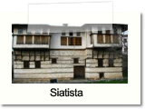
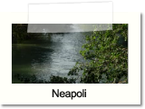
- ‘‘The Villages of Voio’’
- ‘‘The Visitable Monasteries of Voio’’
- ‘‘The Primeval Oak Trees’’
- ‘‘Ontria – A Rare Geomorphological Phenomenon’’
- ‘‘Nature’s Wonders – Footsteps and Human-like Rocks’’
- ‘‘The Waterfalls of Skotomeno Nero – A Natural Monument’’
- ‘‘The Artificial Lake of Vythos – A New Wetland’’
- ‘‘River Pramoritsa and its Waterfalls’’
- ‘‘The Enormous Cliffs of Haros at Pyrgos Kotylis’’
- ‘‘The Peculiar Geology of Mount Voio – Rare Fossils’’
- ‘‘Voio and the Mushroom Madness’’
- ‘‘Voio - The People’’
- Zoupaniotikos Ailias – Voio’s trademark
- Taliaros and its Role during the Civil War
- Thematic Feasts in the Villages of Voio
- Ecology of Voio
- The European Path E6
- Paliokrimini and the Destroyed Village
- Local Products


